Band of Snow Extends Across South Dakota
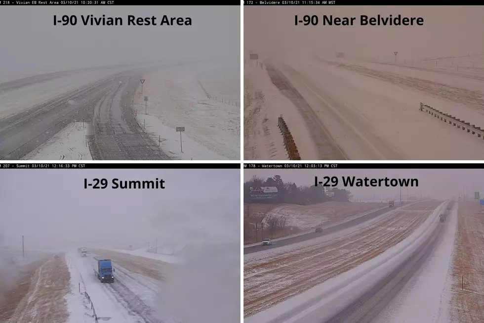
What a difference 24 hours makes. It was just yesterday that Sioux Falls set a record high temperature and now today the clouds moved in with rumbles of thunder and rain. But take a look at the highway cams and you can see that other parts of the region are not as good.
Trolling the South Dakota Department of Transportation camera website you can see that some areas from far southwest near Edgemont to up around the Milbank area are seeing significant snowfall. Road condones have been described as snow-covered, slush, ice, and scattered slippery. Along with that, the visibility in some areas has been reduced.
Travelers are encouraged to take extra caution during the next 24 hours as this system moves through the state. And it would be a good idea to carry your winter survival kit with you for a while longer.

You can connect with the Dakota News Now First Alert Weather Team for the latest forecast and weather conditions in your area.
LOOK: Here are the best small towns to live in across America
More From KYBB-FM / B102.7